
The Fire You Can't See
By Aurore Maxey
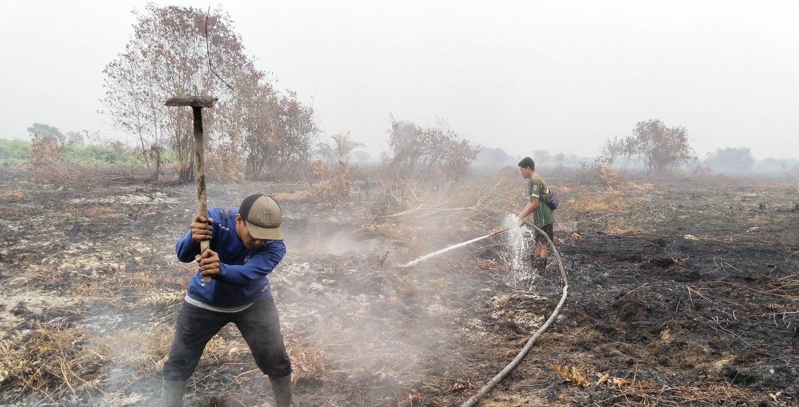
Mengkalang Jambu, Kubu Raya. Beating out and wetting down ground that has already burned, to stop it reigniting.
Fire has moved through more of West Kalimantan this year than almost anywhere else in Indonesia. The outcome of even a small fire depends on who is close enough to reach it in the first hours, and what they are carrying when they get there.
"We make sure there's no live fire and no more smoke coming out," says Pak Langgi. "If there are branches or parts of trees that have gone brittle, usually you need to dig to make sure nothing is still alight underneath."
Pak Langgi runs shifts with PUMK Singa Ruanda, a community governance body in Sintang, in the Indonesian province of West Kalimantan, one of the elected village institutions that hold legal authority over how local forests are managed. He has gone back to the ground his team had already cleared and found it still burning beneath.
When we spoke to him, it was the twelfth consecutive day of fire response. His team works two shifts, seven in the morning until two, then two until eight in the evening, three people on each. What is different from last year, he says, is simply how long the dry season has run, and that the watch has to be tighter because of it.
West Kalimantan recorded the second-highest number of fire hotspots of any Indonesian province this year, and the third-largest burned area. Communities are dealing with weeks of haze, school closures, and water shortages. This is what they are facing, and what village institutions are doing about it.
What has burned
According to the Nusantara Atlas FireWatch platform, between January and August 2026, 895,657 hectares burned across Indonesia, an area more than 11 times the land area of New York City (Gaveau et al. 2026). That is already more than burned in any full year except 2019 and 2023, and the driest months are still to come. NASA FIRMS has recorded 701,856 fire hotspots by 21 September, well ahead of 2019 at the same point in the season, and already 79 percent of the 2019 full-year total. In West Kalimantan, 105,599 hectares burned between January and August. Three-quarters of that burned in August alone.
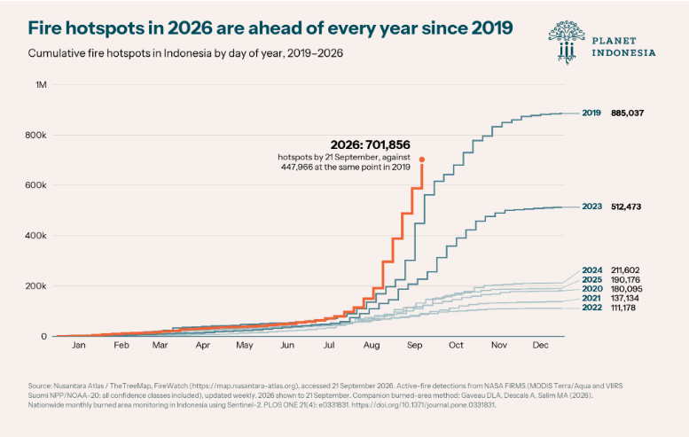
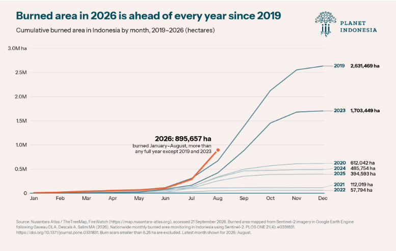
West Kalimantan, the province at the heart of the disaster, has been under forest and land fire emergency-alert status since 2 February, with the status set to run until 15 November. By then, the alert period will have lasted more than nine months.
Indonesia's meteorological agency, BMKG, says the country is experiencing a very strong El Niño. Its late-August monitoring recorded a sea-surface temperature anomaly of +2.74 in the Niño3.4 region of the Pacific. Its September forecast indicates that much of Kalimantan will receive less than 50 mm of rain in every ten days. The dry season is expected to remain severe through September, with rainfall gradually returning from November, and El Niño conditions may persist into early 2027.
The last season on this scale was 2019, when 2.63 million hectares burned across Indonesia. Before that, the 2015 fires put more than 500,000 people into treatment for acute respiratory infections, sent smoke across borders into Malaysia and Singapore, and made international news for weeks. Some of the village fire-response structures still in place today were created in that aftermath.
What this means for people
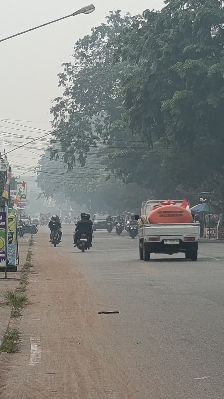
Pontianak under haze. The pickup is carrying a water tank, as the Kapuas drops and salt reaches the city's intake, fresh water gets moved around by road.
The haze here is not an occasional event. People in Pontianak, the West Kalimantan provincial capital, grow up with it. What changes from year to year is how long it lasts and how thick it gets.
This year, people wear masks outside and spend less time in the open. Before getting on a motorbike for anything more than a short trip, they weigh it up. As a Yayasan Planet Indonesia staff member in Pontianak, who has lived in the city his whole life, puts it: "You think twice before you decide to go out."
At the end of August, several thousand people gathered at Masjid Raya Mujahidin, the city's largest mosque, for salat istisqa, a Muslim prayer for rain. Pontianak's mayor, Edi Rusdi Kamtono, said the city had gone more than two months without any rain.
The effects show up in health facilities. Saptiko, head of the Pontianak city health office, said cases of acute respiratory infection had risen to more than 300 per day, up from a normal 100 to 200. Pneumonia remained at around one percent of those cases, with no significant increase in severe cases.
Schools moved online during August. On 30 August, the arrangement was extended again for senior secondary, vocational and special-needs schools. For families, that means managing children's online lessons alongside work and everything else at home.
A water crisis in the world’s ‘rain’ forest
For many people here, the smoke is not the only problem. Water has become another, something unfathomable for a moist tropical rainforest island like Borneo
Pontianak sits near the mouth of the Kapuas, Indonesia's longest river. What keeps the city's water fresh is the volume coming down from upstream, pushing hard enough to hold the sea back at the estuary. This year the Kapuas is low. In places across West Kalimantan, it has begun drying out altogether.
When the freshwater push weakens, each tide carries salt further inland than it should. Pontianak city government records note that in a long dry season, saltwater intrusion can reach around 30 kilometers upstream, far enough to raise salinity at the intake where the city draws its raw water.
The taps still run in houses and hotels, but the water coming out can be salty. Households turn to bottled water for drinking and cooking. Depots run out, queues form, and authorities introduce purchase limits. Prices rise as demand outstrips supply.
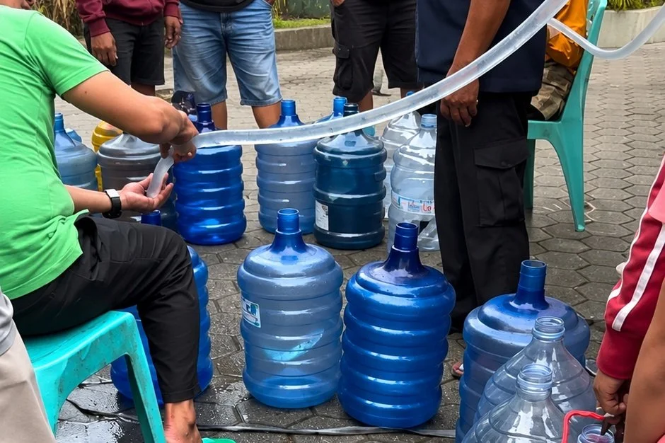
Filling containers at a water point. As the Kapuas drops, salt reaches the city's intake and households buy what they drink.
Health authorities are preparing for the second-order effects. Pontianak's city health office has stocked supplies for diarrhea and respiratory treatments, and the mayor confirmed in late August that the city expected a rise in cases due to water conditions. A doctor at the Kampung Bali community health centre, Muhammad Faisal Haris, warned residents in August that brackish water is less hygienic than what people normally drink, advising that drinking water be boiled first, including water bought from refill depots.
The pattern is documented elsewhere in Kalimantan this season. In East Kotawaringin, in Central Kalimantan, the district health office recorded 3,852 diarrhea cases in the first 28 weeks of 2026 against 3,687 in the same period last year, with weekly cases climbing from 112 to 136 to 155 across three consecutive weeks. Its head attributed the rise to drought and the difficulty of getting clean water.
Upriver, the same low water does something different. In Sintang and Kapuas Hulu, several hundred kilometers inland, the rivers are the roads. When they drop too low for boats, fuel comes overland instead. It arrives late and costs more, in districts that were already the most expensive places in the province to live.
Clean water is now an official concern as well as a household one. On 2 September, the provincial government ordered clean water deliveries to residents in Rasau Jaya, in Kubu Raya district. In mid-September, after roughly three months of the dry season, Pontianak city prepared 1,000 tonnes of fresh water and a 30 percent discount on water bills as salinity rose at the utility's intake. Queues at filling points and rising retail prices have prompted calls for a cross-agency task force to coordinate tanker distribution.
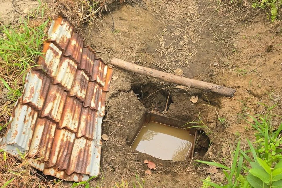
Sungai Nibung. What is left in a hand-dug well at the end of a long dry season.
In several villages across these landscapes, clean water was already short before the dry season reached its peak. In Dusun Tanjung Ruu, in Desa Sungai Nibung, residents describe a single pond still holding fresh water; the others, at people's houses, have turned salty. It is not only people looking for what is left. Bekantan, the proboscis monkeys found only on Borneo, lutung, the leaf-eating monkeys, and other monkeys have been coming down to the settlement and the beach to drink.
Where local supplies run short, the same pumps bought for fire response can move clean water to households. The equipment is held and managed by the village enterprise, so what it does next is a village decision.
Why peat matters here
Much of lowland West Kalimantan sits on peat, waterlogged plant material built up over thousands of years. When wet, it does not burn at all, and it is one of the densest carbon stores on earth. Drained, it becomes something closer to fuel.
Fire on ordinary mineral soil stays on the surface and tends to stop at a plot boundary. Peat fire goes underground. It can smolder beneath the surface for weeks, spreading out of sight, and it is nearly impossible to put out by hand. You can extinguish everything you can see, and it will still be alight underneath. This is what Pak Langgi is testing for when he digs into brittle wood, and what he found when he returned to ground his team had already cleared: wind, and a small point of heat that never quite went out. Close up, he says, you can feel it from two or three meters away.
There is no simple date for when a peat fire is finally out. Teams here work on a rule of thumb: five to seven consecutive days of rain, sometimes more. Not a downpour. Five to seven days.
Until that rain comes, the priority is reaching fires as early as possible, before they get into the peat. On mineral soil, a team arriving within the hour can usually stop a fire where they find it. On drained peat, an hour is often already too late.
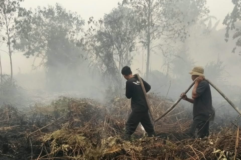
A village team working a fire in thick haze.
Burning, farming and the law
Fires here are not spontaneous. Land gets cleared by burning because burning is fast and cheap, and fire does not respect the boundary somebody drew for it.
Some smallholder farmers still use fire to prepare agricultural land, as their families have for generations. In normal conditions, a small controlled burn stays inside the plot, the rain comes, and the ash feeds the next crop. This year, prolonged dryness and low water levels in peat make any use of fire considerably more dangerous.
This is not only an outside observation. Asked what worried him most about the coming weeks, Pak Langgi said that if the long dry season continues, there is a real possibility of more fires, and that some will come from activities carried out by people in the surrounding communities. He was describing the risk from inside it.
Indonesian law prohibits clearing land by burning, under Article 69(1)(h) of Law No. 32 of 2009. The following paragraph requires the prohibition to account for local wisdom, and the law's explanatory notes define it precisely: up to two hectares per household, planted with local varieties, surrounded by a firebreak.
That position changed on 31 August, while this fire season was already underway. Presidential Instruction No. 11 of 2026 narrowed the exception considerably. It now applies only where every condition is met together: a customary practice that can be identified and verified, two hectares per household, strict firebreaks, non-commercial local food crops at subsistence scale, and a government recommendation and accompaniment first. Burning is excluded entirely on peat and within 500 metres of it, and the exception cannot be invoked after an emergency declaration until the emergency, alert and transition periods have all been declared over. It is not available to companies, commercial plantations, mining operations or concession holders at all. The instruction also directs strengthened criminal, civil and administrative sanctions against anyone who carries out, orders, facilitates or allows burning.
The practical effect in a drained peat landscape under emergency status is that there is currently no lawful way to clear land with fire. Not for companies, and not under local wisdom either.
Communities practising customary burning apply their own rules: not burning during drought, limiting the area, building firebreaks, and staying with the fire until it is out. The distinction the law draws still matters, even where the exception is currently closed. Customary burning within the two-hectare provision is not the same thing as large-scale land clearing. But public information now has to communicate a rule that has genuinely changed, in landscapes where the exception no longer applies, without treating the people it affects as the cause of the season.
What villages are doing
Across four landscapes in West Kalimantan: Kubu Raya, Gunung Naning, Gunung Nyiut Penrissen, and the Karimata Islands, community governance bodies in 32 villages, home to around 27,000 people, hold authority over how their forests and coastal ecosystems are managed. These are elected village-level institutions with legal standing in Indonesian law, not project committees, and they operate year-round. When fire season starts, the response is not built from scratch. Planet Indonesia works alongside them.
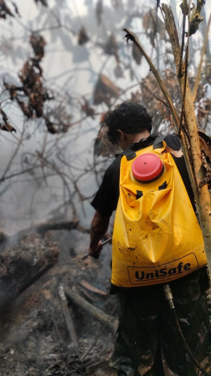
Backpack sprayers are what teams carry where a pump cannot reach.
District governments are reaching the same conclusion. On 1 September, the head of Landak district declared a full karhutla emergency, tanggap darurat, a step above the province's alert status. On 10 September, the district's community empowerment office wrote to every village head, instructing them to establish a village command post and task force, chaired by the village head with the chair of the village council as deputy, drawing in hamlet heads, neighbourhood heads, village institutions and volunteer disaster teams. Their assigned tasks: routine patrol, early detection of hotspots, real-time reporting to the sub-district post, and protecting infants, children, older people, pregnant women, and people with asthma from the smoke
Many of these villages already had a similar structure. Five village heads in these landscapes are now acting on the instruction.
Twice a day, at 09:00 and 14:00, hotspot data arrives from SiPongi, Indonesia's national fire monitoring system, which detects heat signatures by satellite and assigns each a confidence rating. Village teams check the medium- and high-confidence detections in person, because a satellite sees heat, not fire. SiPongi is a different system from the NASA FIRMS feed behind the national figures above, and the teams act on a narrower, filtered set of detections.
Not every fire arrives that way. Pak Langgi says information reaches his team from two directions: the hotspot data, and neighbours who saw something. On the morning of 6 September, a monitoring team in Kenyabur, in Ketapang, came across a fire on a round they would have walked anyway. It had already started. They had a pump, hose, and protective gear, and they worked it as far as the hose would reach.
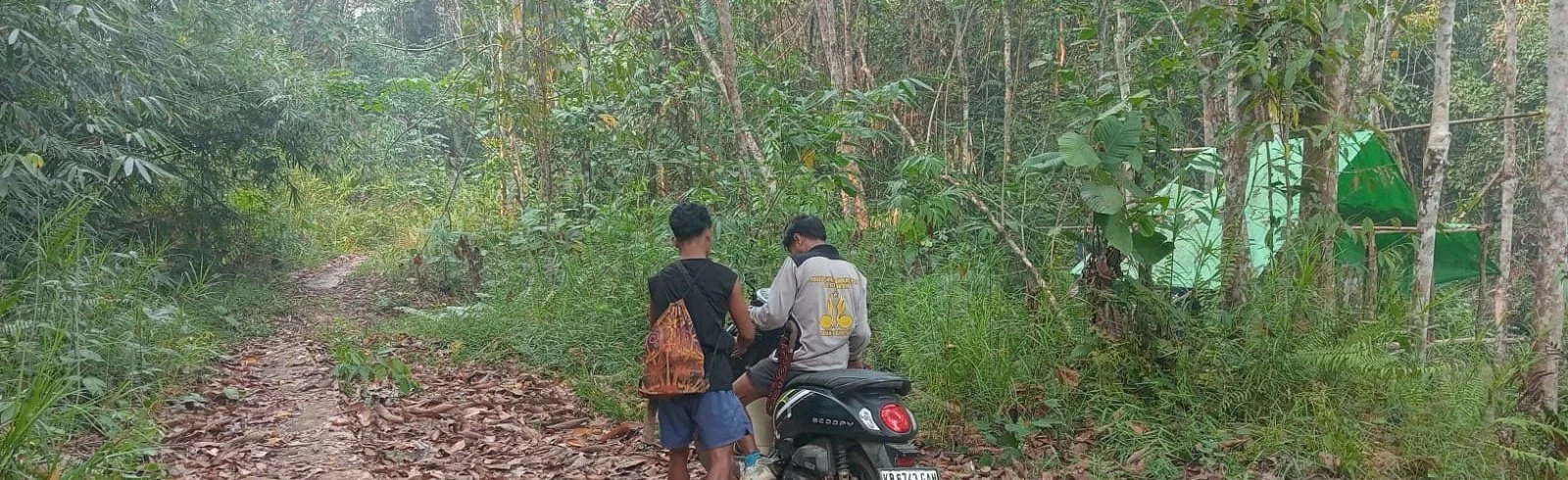
Reaching a fire means getting there first. A patrol team arrives at the edge of a burn.
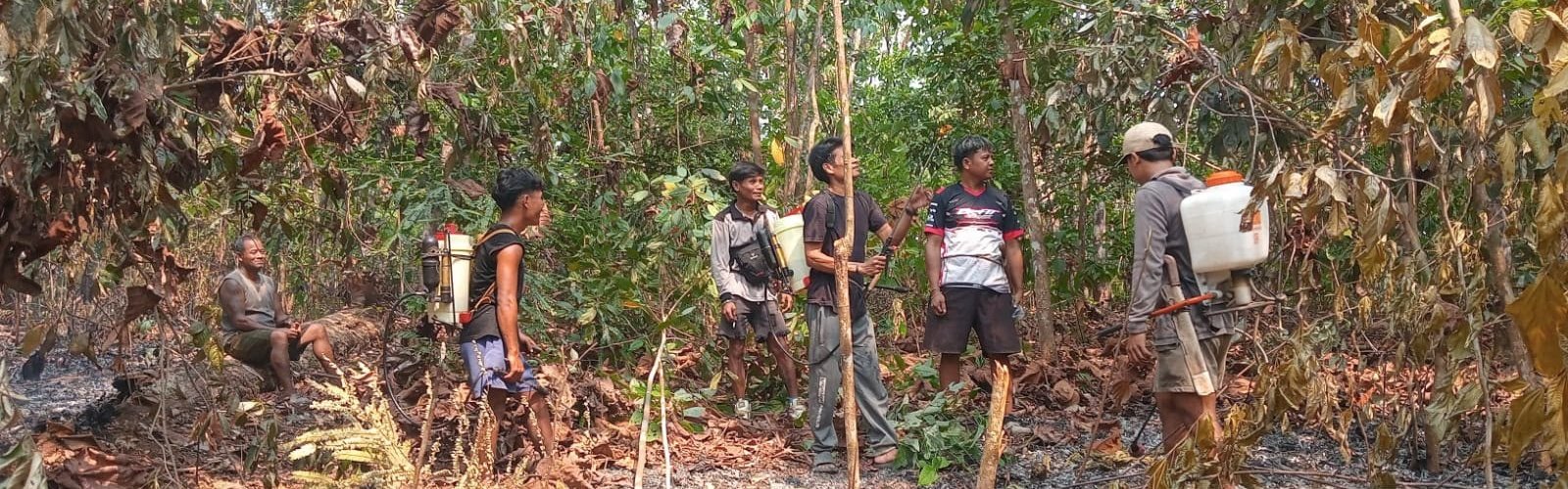
A village team on ground that has already burned.
Teams map the nearest usable water source before they need it, and coordinate with the national fire brigade, the disaster agency, the forest management unit and the conservation agency when a fire is larger than a village can handle. Equipment is bought as close to the village as possible so it arrives in days rather than months. Volunteers are chosen in open village meetings rather than appointed by any individual, rosters are recorded and checked, and payment follows verified attendance on shift. Any equipment provided for fire response stays in village hands afterwards.
Some of the equipment has arrived. Pumps, hoses, and protective gear have been handed to teams in Mengkalang Jambu, Seruat Dua, Mengkalang, and Dabong, in Kubu Raya. In Beginci Darat, a village fire response team has formed, and when the district forestry unit visited for seedling nursery training, the session was extended to cover the firefighting equipment and how to use it.
Some of it has not. On 15 September, a team in Desa Tanjung Harapan, in Kubu Raya, saw a fire on the side of Gunung Bongkok spreading towards houses. Six of them worked on it from half past five in the morning until eleven. They recorded two constraints afterwards: not enough water to run the pump, and not enough hose to reach the water that was there.
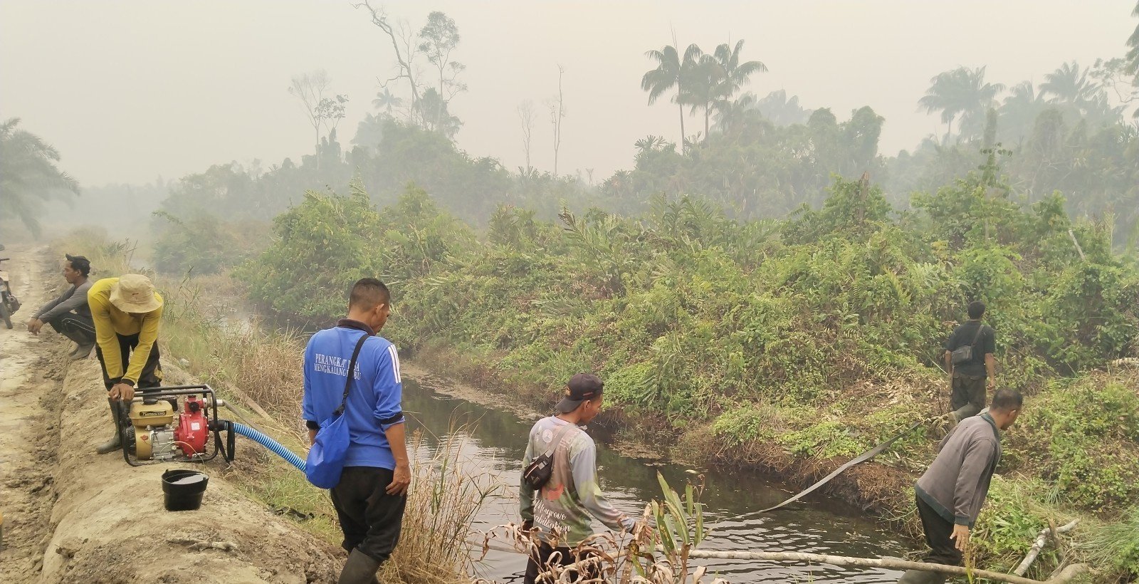
A team drawing water from a canal at Mengkalang Jambu.
There is a limit to what the national figures can show. The burned-area data excludes any burn scar smaller than 6.25 hectares, a threshold Nusantara Atlas adopted to match the minimum mapping unit Indonesia's Ministry of Forestry uses for its own national assessments, and the method misses roughly a third of burned area outright, most often where fire burns at low intensity beneath a forest canopy or where haze obscures the scar. Both conditions describe West Kalimantan in a smoke season. The omission is deliberate: the product is built so that an area labeled as burned has, with very high confidence, burned. So the fire the Kenyabur team put out on 6 September is in none of these figures, and neither is any fire stopped at that scale. The national total is a record of fires that got away, which is why the evidence for what village institutions change has to come from somewhere else.
There is evidence that this kind of village governance holds under pressure. Planet Indonesia's monitoring, using a matched-pair design comparing villages with community governance bodies against similar sites without them, found 74 percent less forest loss than matched controls in 2024, up from 65 percent in 2023. During the pandemic, when outside monitoring largely stopped, affiliated villages showed 68 percent less forest loss than controls, up from 52 percent in the period before it.
Fire detections have also been lower inside these landscapes this season. Between 5 and 31 August, satellite fire detections per 1,000 km² ran 57 percent lower in Cagar Alam Gunung Nyiut, 77 percent lower in Hutan Lindung Gunung Naning and 86 percent lower in the coastal village forests of Kubu Raya than the rate across West Kalimantan as a whole. These are unmatched comparisons against the provincial rate, so land cover, peat extent and accessibility all differ between them. They show where fire was detected, not what caused the difference.
What needs to happen next
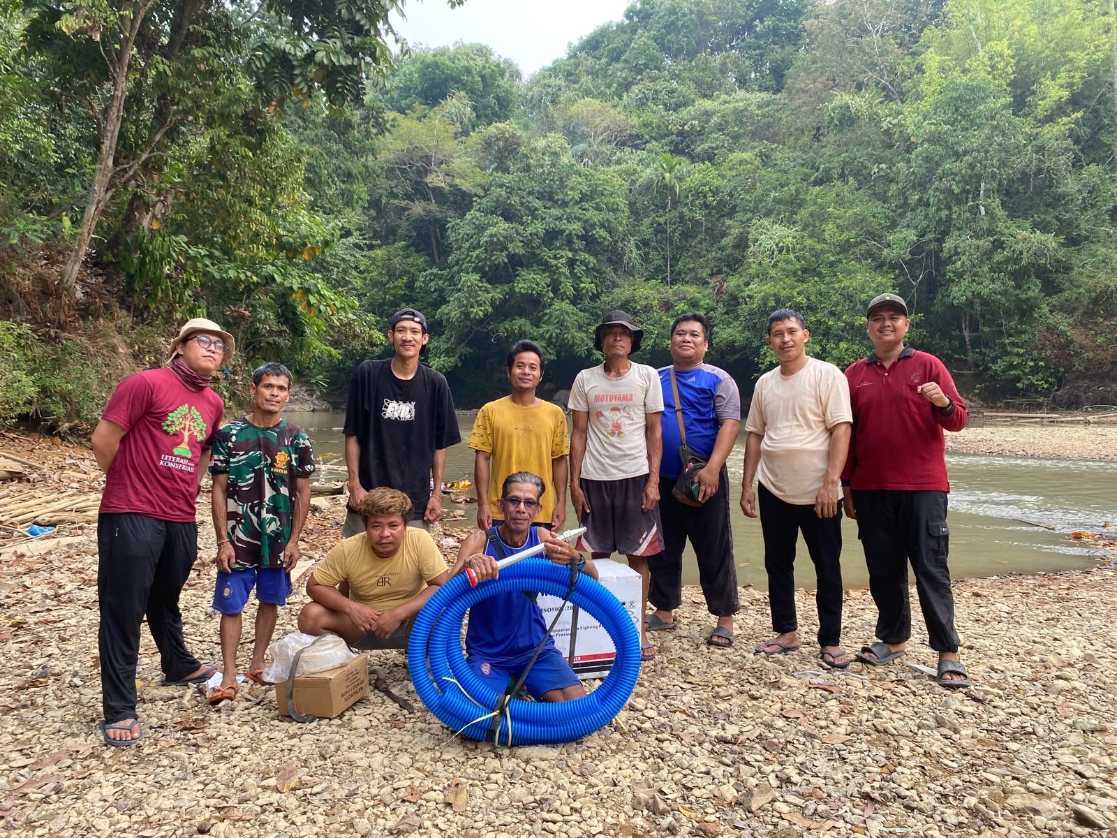
Equipment reaching a village team. Hose and pumps are bought at district level so they arrive in days rather than months.
Community governance bodies across the four landscapes have costed what the rest of the season needs, together with Planet Indonesia — patrol shifts, equipment, daily hotspot checks, water source mapping, and relief for households hit by fire. The equipment is arriving. The day-to-day costs of keeping teams on shift through December, food, fuel, and compensation for time spent patrolling instead of working, are not yet funded.
Two villages have now said the same thing independently, a week apart. The Kenyabur team worked their fire as far as the hose would reach. Tanjung Harapan had water and not enough hose to reach it. That is not a detail about one bad morning. It is the difference between a fire that stops where it started and one that gets into the peat.
The same problem will return. Village teams need equipment, current information, and enough operating support to respond in the first hours. Keeping peat wet through the dry months matters more than anything you can do once a fire has started.
Eventually the rain will come. It will need to fall for days before the peat is out. As river levels rise, the salt will retreat down the estuary and fresh water will return to the taps.
In Sintang, Pak Langgi's team will start the morning shift at seven. Most days they will find nothing. What they carry is measured entirely in fires that never grew large enough for anyone to count.